About Floodplains
Types of Flooding
Unique Flood Hazards
Understanding Flood Risk
About Floodplains
Every body of water, from the smallest creek to the largest ocean, has a floodplain associated with it. Simply put, the floodplain is the normally dry land area that is susceptible to inundation when water levels rise higher than normal.

The “base flood” – also known as 100-year flood or 1-percent annual chance floodplain – refers to the level of flooding within the floodplain that has a 1 percent chance of being equaled or exceeded in any given year; the land covered by the base flood is known as the special flood hazard area (SFHA). “The computed elevation to which floodwater is anticipated to rise during the base flood is the Base Flood Elevation (BFE).”

The 1-percent standard is a probability statement – larger floods can and do occur somewhere in the U.S. every year. Just because a specific location hasn’t flooded in many years (or has experienced multiple floods) doesn’t change the probability of further occurrence. Additionally, floodplains can shift and expand over time as a result of development and land use changes, increasing the number of properties at risk of flooding. Moreover, climate-related changes are exacerbating flood risk in many places and increasing the probability that floods will occur.

Types of Flooding
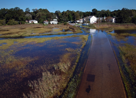
There are three main categories of flooding: riverine, coastal, and shallow.
Riverine Flooding
Rivers, streams, creeks, and drainage ditches are all types of channels that carry water through and out of a watershed. A channel’s size and its surrounding terrain determines a flood’s dynamics. Will it be deep or shallow? Slow or fast moving? Will people have advanced warning or no warning? Will it last for only a few hours or for days?

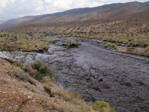
River at risk of overtopping. Image by hey tiffany! via Flickr; licensed under CC BY-NC 2.0
Overbank flooding is the most common type of riverine flooding, where a channel’s floodwaters exceed its capacity and flow into the floodplain. Depending on the terrain around the channel, a flood can be anywhere from:
- shallow, slow moving (with heavy rainfall or snowmelt occurring upstream days prior), and lasting for days in relatively flat areas, to
- deep, fast moving (with heavy rainfall having fallen only minutes before), and lasting for only a few hours, especially in hilly and mountainous areas.
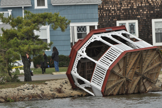
Coastal Flooding
Coastal flooding is typically the result of sea level rise and coastal storms as well as their associated storm surge along the Atlantic, Pacific, Gulf Coast, Great Lakes, and other estuarine shorelines.

Flooded road in neighborhood. Image by Aileen Devlin | Virginia Sea Grant via Flickr; licensed under CC BY-ND 2.0.
Storm surge occurs when high winds and air pressure cause large bodies of water, such as oceans, to rise several feet above normal, resulting in highly destructive waves. These waves batter the coast, destroying buildings and natural systems along the shore, usually in tandem with damaging high winds.
The magnitude of coastal storms makes them the costliest of all extreme weather disaster events. While the damage they cause to human-made development is often the most talked about, the damage coastal flooding can cause to natural systems is also important to acknowledge. As shorelines, sand dunes, bluffs, and barrier islands erode, flood risk to lives and property increases.
Of note, coastal communities can also be at risk of riverine flooding if they are in a riverine floodplain as well as a coastal one — and coastal communities in the Pacific and Caribbean are also at risk of tsunamis due to tectonic activity.
Shallow Flooding
Shallow flooding occurs when water does not have anywhere to easily drain, whether as a result of a lack of defined channels or as a result of overwhelmed channels in areas in which the ground cannot absorb flood waters quickly enough.
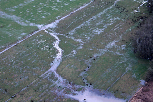
Flooded field. Image by Eric Prado via Flickr; licensed under CC BY-NC 2.0
There are three main categories of shallow flooding: ponding, sheet flooding, and urban flooding.
Ponding occurs when rainwater accumulates in depressions and cannot drain out — creating temporary ponds.
Sheet flooding occurs when rainwater during a prolonged rain event can no longer be absorbed into the ground and has no channels by which to flow away; instead, water spreads out and flows downhill, covering a wide area like a sheet.
Lastly, urban flooding happens when drainage systems such as ditches, stormwater infrastructure, retention ponds, etc. are overwhelmed and cause stormwater to exceed the capacity of the system.
Unique Flood Hazards
In addition to riverine, coastal, and shallow flooding, there are a number of circumstances in which unique flood hazards occur: in an urban area, near a large lake that does not drain into a river or ocean, near the base of a mountain, in a hilly or mountainous area, in a desert area, near a river or stream in a cold weather region, downstream of a dam, or in an area prone to wildfire.
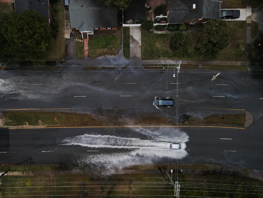
In an urban area
Impervious surfaces (roofs, parking lots, streets, and roadways) in urban areas mean more rainfall runs off of the land, accumulating in waterways and overflowing into floodplains. Changes in drainage patterns that usually go along with development (gutters, ditches, and piped storm drains) can shorten the time it takes for runoff to reach streams, quickly overloading them. Even in areas where on-site management of stormwater runoff is mandated, stormwater ponds and other features aren’t designed to handle the extreme rainfall experienced in many areas that can produce damaging floods.

Urban flooding. Image by Aileen Devlin | Virginia Sea Grant via Flickr; licensed under CC BY-ND 2.0.
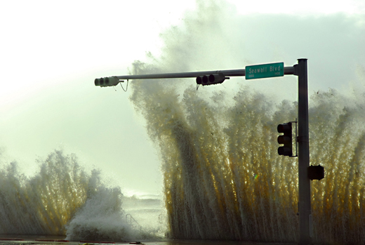
Near a large lake that does not drain into a river or ocean
Those who live along the shores of lakes with no, inadequate, regulated, or elevated outlets, such as the Great Lakes or Great Salt Lake, need to be aware that heavy rainfall or snowmelt combined with strong winds in the region can cause extreme lake level fluctuations. If waters rise faster than they can drain, water levels can stay high for weeks to years, making flooded properties unusable for that duration of time.

Failed seawall along Lake Michigan due to sustained high lake levels. Photo courtesy of Dave Fowler.
Near the base of a mountain
Alluvial fan flooding may occur near the base of a mountain in mountainous regions during flash floods, when high-velocity floodwaters move quickly downhill before sharply losing speed once they reach the base of the valley. When the floodwaters lose speed, they fan out like a sheet flood, depositing sediment and debris they’ve transported from uphill into the valley. Not only can the channel of an alluvial fan flood occur in a different location from flood to flood, but it can move across the ‘fan’ during a flood event.

An alluvial fan flood in progress. Photo courtesy of Randy Behm.
In a hilly or mountainous area
Those who live in hilly or mountainous areas should also be aware of mudflows. Mudflows are a type of landslide caused by liquid mud flowing down a hillside as a result of an accumulation of water during a period of heavy rainfall. They can cause extensive damage to structures within their paths. It is worth noting that while mudflows are covered by flood insurance, landslides are not.
Mudflow at Harris Springs Road in Toiyabe National Forest near Humboldt, NV, in 2013. Forest Service photo by Bobby Olds via USDA Flickr; licensed under CC BY 2.0.
In a desert area
Moveable streambeds occur when high velocity floodwaters cause sand or loose soil in arid regions to erode, build up, or migrate along a channel, changing the channel’s pathway and location mid-flood. These changes to flow paths mean that properties at risk of flooding can change from flood to flood and even mid-flood.
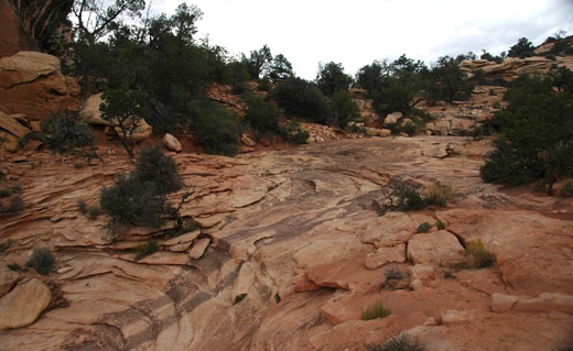
Dry creek bed in Utah. Image by James St. John via Flickr; licensed under CC BY 2.0.
Near a river or stream in a cold weather region
Those who live in cold weather regions need to be aware that frozen rivers and streams can cause ice jams when those channels begin to thaw. Ice jams can cause flooding upstream – before they break – and flooding downstream – when they break. Additionally, a broken ice jam can carry large debris which can further damage buildings located along the channel.
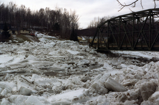
An ice jam in Georgia, VT, in 1984. Image by VTrans via Flickr; licensed under CC BY-NC-ND 2.0.
Downstream of a dam
Those who live downstream from a dam need to be aware that dams may overtop or fail given the challenges posed by aging infrastructure, an extreme flood event, or if not properly maintained. A dam failure may result in a surge of deep and fast moving water damaging structures and infrastructure for miles downstream from the dam.

Lewis and Clark Lake draining at Gavins Point Dam, South Dakota, on the Missouri River, June 2011. Photo courtesy of Randy Behm.
Behind a levee
Levees are designed to provide protection against a specific level of flooding. If you reside in an area protected by a levee, be aware of major flood events which may pose a threat to the integrity of the levee. Overtopping or breaching of the levee during such a flood event could place you, your property, and possessions at risk of flooding.

Missouri River levee failure in 2011. Photo courtesy of Randy Behm.
In an area prone to wildfire
In addition to trees with vital root systems, wildfire can burn away important vegetative cover and other plant life. Losing this vegetation which usually absorbs rainfall can cause changes in land use and increased runoff, which can lead to flash flooding and mudflows.
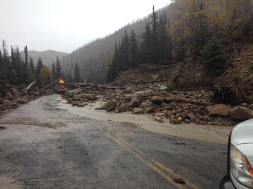
Debris and mudflow blocking road. Image by Utah DOT via Flickr; licensed under CC BY-NC 2.0.
Understanding Flood Risk
Understanding flood risk is critical. Floods can vary in size and how often they occur.
Engineers use various methods to analyze these two factors, also called magnitude and frequency, to determine an area’s overall probability of flooding. The flood risk information is then put in a map format that is more easily used by property owners, planners, developers, builders, engineers, and architects as they decide how and where to build or improve structures and how to undertake development.
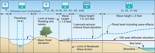
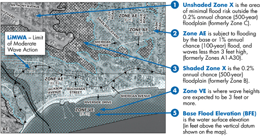
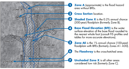
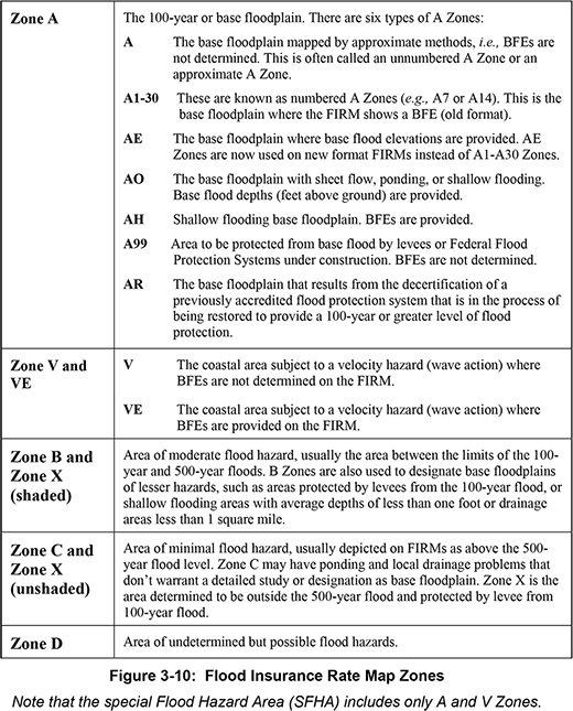
Flood Insurance Rate Maps
Flood Insurance Rate Maps (FIRMs) contain information on the community’s Special Flood Hazard Areas (SFHA), including projected Base Flood Elevations (BFE), flood velocities, and flood risk zones. A flood zone is an easy way for a property owner to have a very basic understanding of their property’s flood risk; it also feeds into how flood insurers determine a property’s flood insurance premium. Communities use FIRMs as they apply floodplain management regulations and make decisions.
Future Flood Risk
Flood risk is not static – it changes constantly due to development, erosion, land use changes, subsidence of the land, changes in rainfall patterns, sea level rise, and other factors. This can be difficult to understand because flood maps with “precise” floodplain boundaries and elevations give the impression that the lines are fixed and definitive. Always keep in mind that flood risks are likely to change over time due to natural processes, development, climate change, and other factors. This means buildings designed to comply with today’s minimum requirements could be subject to future flooding.
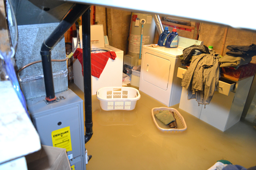
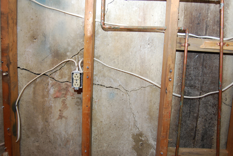
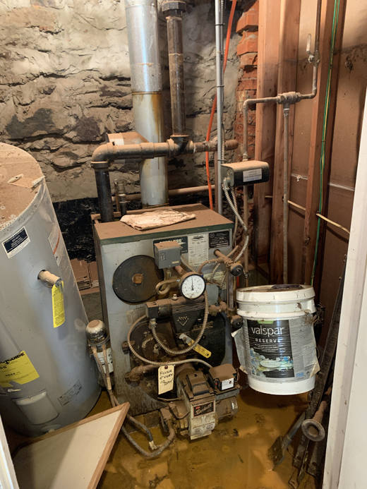
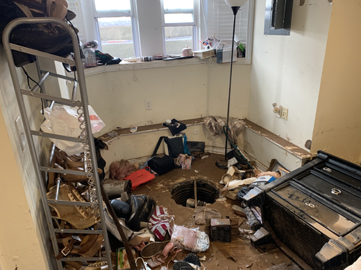
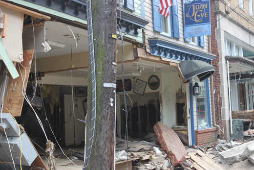
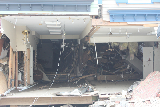
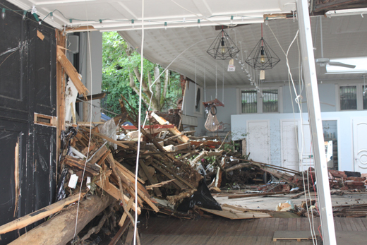
Flood Damages
If you own property in a flood-prone area, your structure may be at risk of incurring a range of potential flood-associated damage, such as
- A compromised foundation
- Floating off its foundation
- Damaged, warped, or collapsed walls
- Warped wooden supports
- Cracked basement floors
- Mold and mildew
- Contamination due to leftover sediment and other contaminants, such as animal carcasses, absorbing into materials or collecting in piles on, in, and around the property and its contents
- Damaged utilities (e.g., electric, gas, water, etc.)
- Damaged building contents
- Debris left behind when floodwaters recede


So, what can you do?
To help you narrow down your search results based on your answers to a series of questions about your property and its flood history, if known.
Key filters are available to aid in your decision making, such as how much each option may cost to implement, how much annual maintenance will be required, and if you can implement it yourself or if you should engage a registered design professional. You can also compare options against each other using a compare feature.